The Prestige Place Mumbai Direction And Distance
Featured Image of The Prestige Place Mumbai Direction And Distance


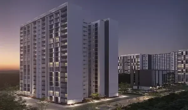
The Prestige Place Mumbai Direction and Distance places this 15-acre residential township on Ghodbunder Road in Thane West, exactly 6.5 km from Thane Railway Station and 28.5 km from Mumbai Airport (CSMIA). It holds 2,900 homes spread across 8 tall towers that stand between 44 and 55 floors high. The project sits right on the main road that links the Eastern Express Highway to the Western Express Highway. Drivers coming from South or Central Mumbai head northeast along the highway, while people driving from Borivali head east around the national park hills. The new Mumbai Metro Line 4 runs straight along this belt, giving daily office-goers an easy way to reach jobs in Mulund, Powai, Airoli, and BKC without long delays.

The Prestige Place Mumbai Distance to Key Rail and Transit Hubs


Thane Railway Station is only 6.5 km away to the southeast, serving as the main train stop for both Central and Harbour local lines. You can hop on local trains here that run straight to Dadar, CSMT, and Kalyan every two to three minutes.

The new Mumbai Metro Line 4 runs right along Ghodbunder Road, covering 23.2 km between Wadala and Kasarvadavali. When it opens, the nearby metro station will give you a quick ride across town without getting stuck in road traffic.

  • Thane Railway Station: 6.5 km southeast, taking about 20 minutes by auto or cab.
  • Mumbai Metro Line 4: Steps away from the gate on Ghodbunder Road, running 23.2 km down to Wadala.
  • Eastern Express Highway: 5.8 km south, giving you a clear run toward Mulund, Ghatkopar, and Chembur.
  • Western Express Highway: 21 km west, taking you straight to Borivali and National Highway 48.
  • Mumbai International Airport (T2): 28.5 km away via the Eastern Express Highway and SCLR link.

Driving Directions from Major Mumbai Commercial Centers


You can drive to The Prestige Place Mumbai from any major Mumbai office area by sticking to wide highways and flyovers.

Route Directions from Bandra Kurla Complex (BKC)

BKC sits about 31 km to the south, and the drive takes around 60 minutes in normal traffic. Start on the BKC connector, take the SCLR over to the Eastern Express Highway, and drive straight north. Stay on the highway past the Mulund toll naka until you enter Thane West. Take the Majiwada flyover straight onto Ghodbunder Road, and the project gates appear right along your left side.

Route Directions from Powai and Vikhroli

Powai is roughly 22 km away, and the drive takes between 40 and 45 minutes. Take the JVLR road east until you hit the Eastern Express Highway, then turn north toward Thane. Drive up the main flyovers to bypass city signals until you reach the start of Ghodbunder Road. Stay in the middle lane, exit onto the local service slip, and pull straight into the township entry.

Route Direction from Western Suburbs (Borivali and Kandivali)

Borivali sits 21 km to the west, making this an easy 35-minute drive. Head east along Ghodbunder Road, driving along the green edge of Sanjay Gandhi National Park. This wide road runs straight through the hills and brings you right into Thane West without having to drive through South Mumbai traffic. Follow the road past the main intersection, make a smooth turn, and you reach the front gates.

Distance to Nearby Schools, Hospitals, and Retail Hubs


The Prestige Place Mumbai is close to top schools, good hospitals, and big shopping malls, all within a 15-minute drive.

Place Type Place Name Road Distance Normal Drive Time
Hospital Bethany Hospital 4.8 km 10–12 mins
Hospital Jupiter Hospital 5.2 km 12–15 mins
School CP Goenka International School 3.5 km 8–10 mins
School Singhania School 6.0 km 15–18 mins
Mall Viviana Mall 4.9 km 10–14 mins
Mall KORUM Mall 6.2 km 15–18 mins

Micro-Market Connectivity and Regional Road Infrastructure


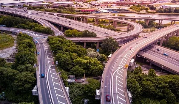
Ghodbunder Road is a wide 6-to-8 lane highway that connects the eastern side of Mumbai to the western side. Modern flyovers at key stops like Manpada and Patlipada keep fast cars moving while letting local traffic use the ground lanes safely.

Daily life here is made simple by regular city buses, local autos, and app-based cabs that run day and night. The planned twin road tunnels between Thane and Borivali will also cut travel time down to just 15 minutes once finished.

  • Wide Lanes: 6 to 8 lanes of smooth asphalt with high flyovers to avoid traffic lights.
  • City Buses: Regular TMT and BEST buses stop often to take riders to Thane Station and Borivali.
  • Local Rides: Plenty of auto-rickshaws, shared cabs, and private app taxis wait right by the main roads.

FAQs


1. What is the exact distance between The Prestige Place Mumbai and Thane Railway Station?

Thane Railway Station is 6.5 km away from the project gates. An auto-rickshaw or taxi ride takes about 20 to 25 minutes depending on the time of day.

2. Which main highway leads directly to The Prestige Place Mumbai?

Ghodbunder Road (NH 48) is the main highway right outside the project. It gives you a direct link to both the Eastern Express Highway and the Western Express Highway.

3. What is the driving distance from Mumbai Airport?

Mumbai International Airport (Terminal 2) is 28.5 km away. The drive takes about 50 to 70 minutes using the Eastern Express Highway and SCLR flyover.

4. How do you drive to The Prestige Place Mumbai from Borivali?

Take Ghodbunder Road straight east past the national park border for 21 km. The road is open, wide, and brings you straight to Thane West in about 35 to 40 minutes.

5. How close is the new Mumbai Metro Line 4 to the project?

Metro Line 4 runs straight along Ghodbunder Road, just a short walk or quick rickshaw ride away. This line connects you all the way from Kasarvadavali down to Wadala over 23.2 km of track.

Enquiry
Enquire Now